Catastrophic glacier collapse in Nepal and Tibet:
Satellite images show the extent of the destruction.
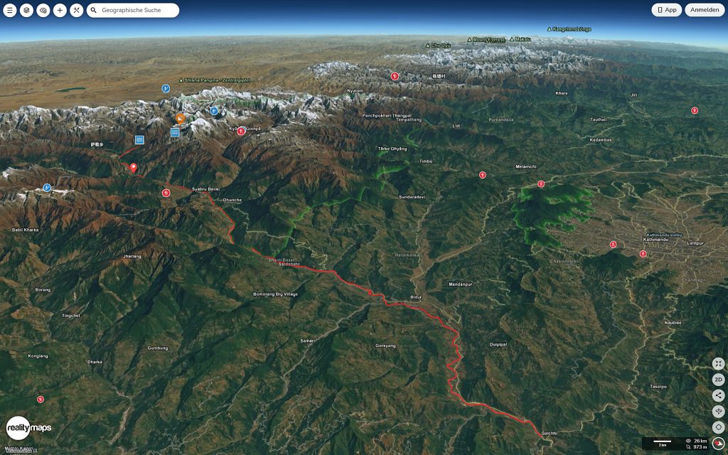
On the morning of August 26, 2026, a massive flash flood in Nepal and Tibet caused widespread devastation along the Bhotekoshi and Trishuli rivers.
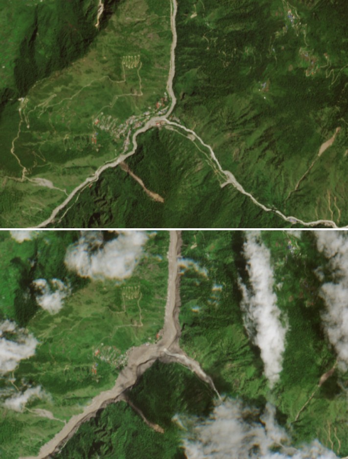
Recent images from the European Sentinel-2 satellite (ESA), captured shortly before and after the event, document the full extent of the disaster: numerous settlements along the river courses were partially or completely destroyed.
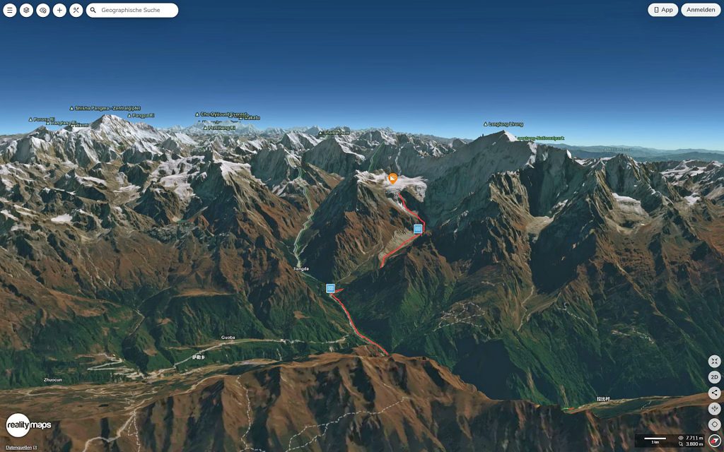
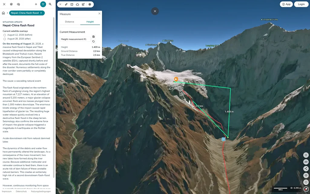
The flash flood originated on the northern flank of Langtang Lirung, the region’s highest peak at 7,227 meters.
A massive glacial collapse occurred at an altitude of approximately 5,200 meters.
Masses of rock and ice plunged more than 1,300 meters. The enormous kinetic energy of the impact caused the glacial ice to liquefy instantly. The resulting massive volumes of water rapidly transformed into a destructive flash flood as they surged down the steep terrain.
The Case of Batrawati: Floodwaters Rise up to 25 Meters
The village of Batrawati serves as a prime example of the devastating force of the surging waters.
There, the river swelled dramatically in a very short time, reaching levels of up to 25 meters above the normal bank height. The raging flood wave tore through the valley with unimaginable power, simply washing away numerous homes and roads in the village.
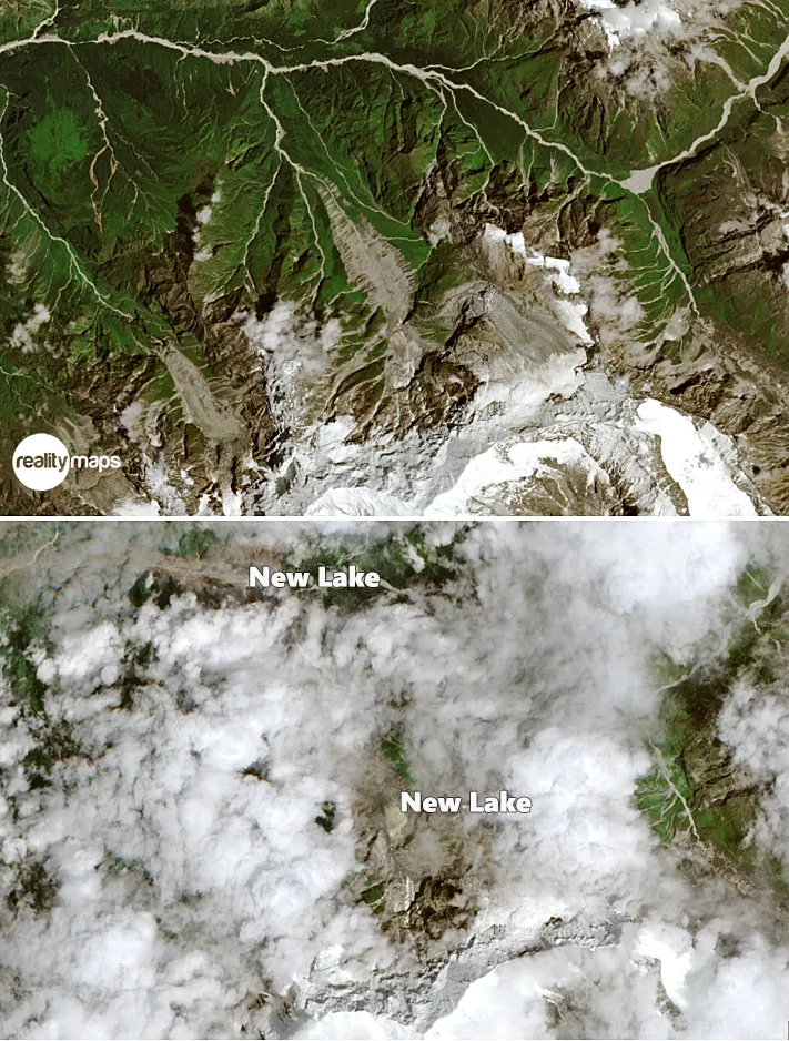
Top: Sentinel-2 image from 12 August 2026 Bottom: Sentinel-2 image from 28 August 2026
Image credits: Sentinel-2 satellite images (European Space Agency - ESA)
Acute risk posed by new natural reservoirs
The dynamics of the debris and water flow have permanently altered the landscape. As a result of the mass movement, two new lakes have formed along the river’s course.
With the continuous inflow of meltwater and rainwater, there is an acute risk that these unstable natural barriers could fail. This presents an extremely high risk of a second, downstream flash flood wave.
Comprehensive satellite monitoring is currently hampered by dense cloud cover over the region, which obscures sections of the river’s course.
Top: Sentinel-2 image from 12 August 2026 Bottom: Sentinel-2 image from 28 August 2026
Image credit: Sentinel-2 satellite (European Space Agency - ESA)