Follow Jost live!
Jost Kobusch is back in the Himalaya and has big plans: In winter 2019/2020, Jost reached a highpoint of almost 7.300 m on the rarely climbed Everest West Ridge. This winter he is back again, solo and without supplemental oxygen. He will be sending us his live positions with his tracking device Garmin inReach Mini which is currently set to a 1-hour-intervall.
You can follow his exciting and ambitious journey in our Live Tracker!
As part of his acclimatization program, Jost was already able to summit Purpung Himal (6.500 m), an unclimbed 6000er in the Annapurna region.
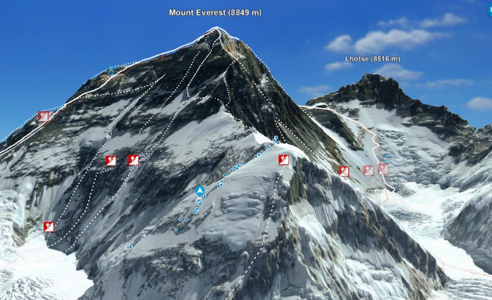
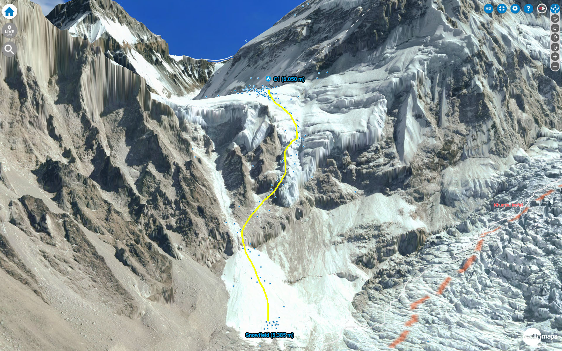
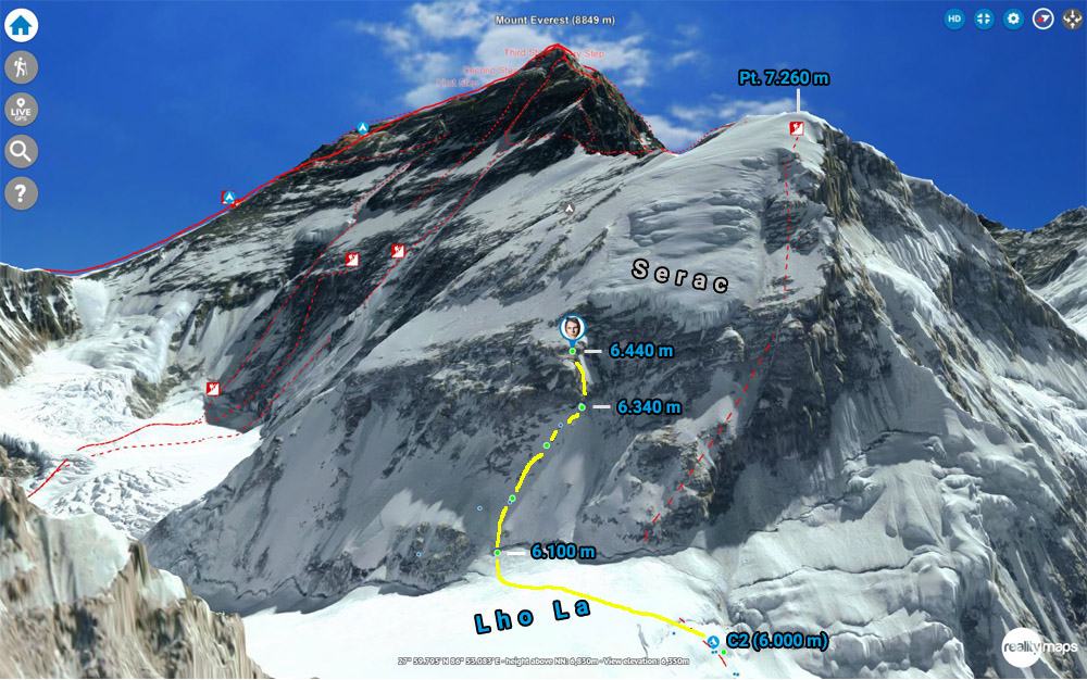
Screenshot from Jost’s previous attempt on Everest West Ridge (2019/2020).
The blue dots are his GPS positions.
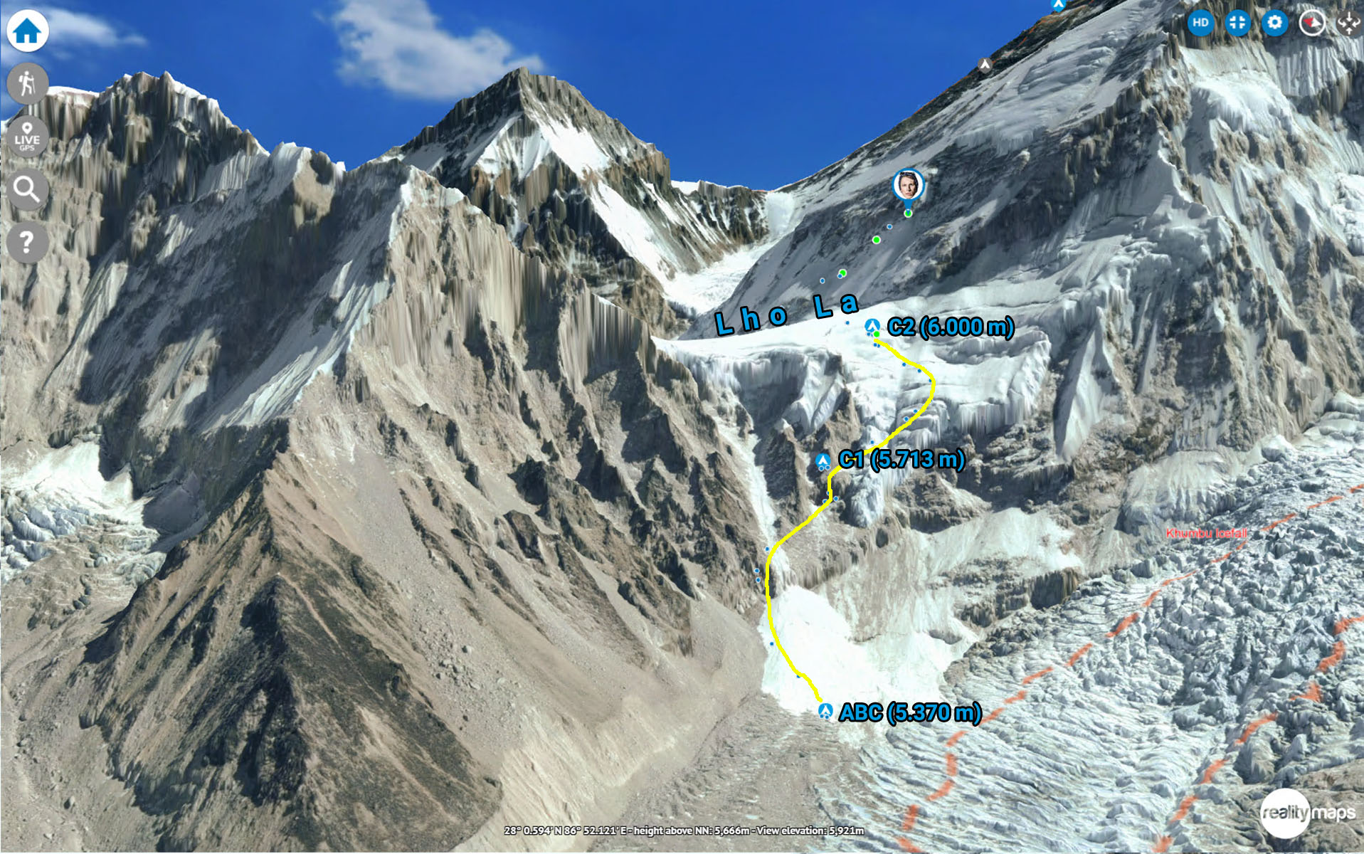
Mount Everest via the West Ridge
From BC to C1
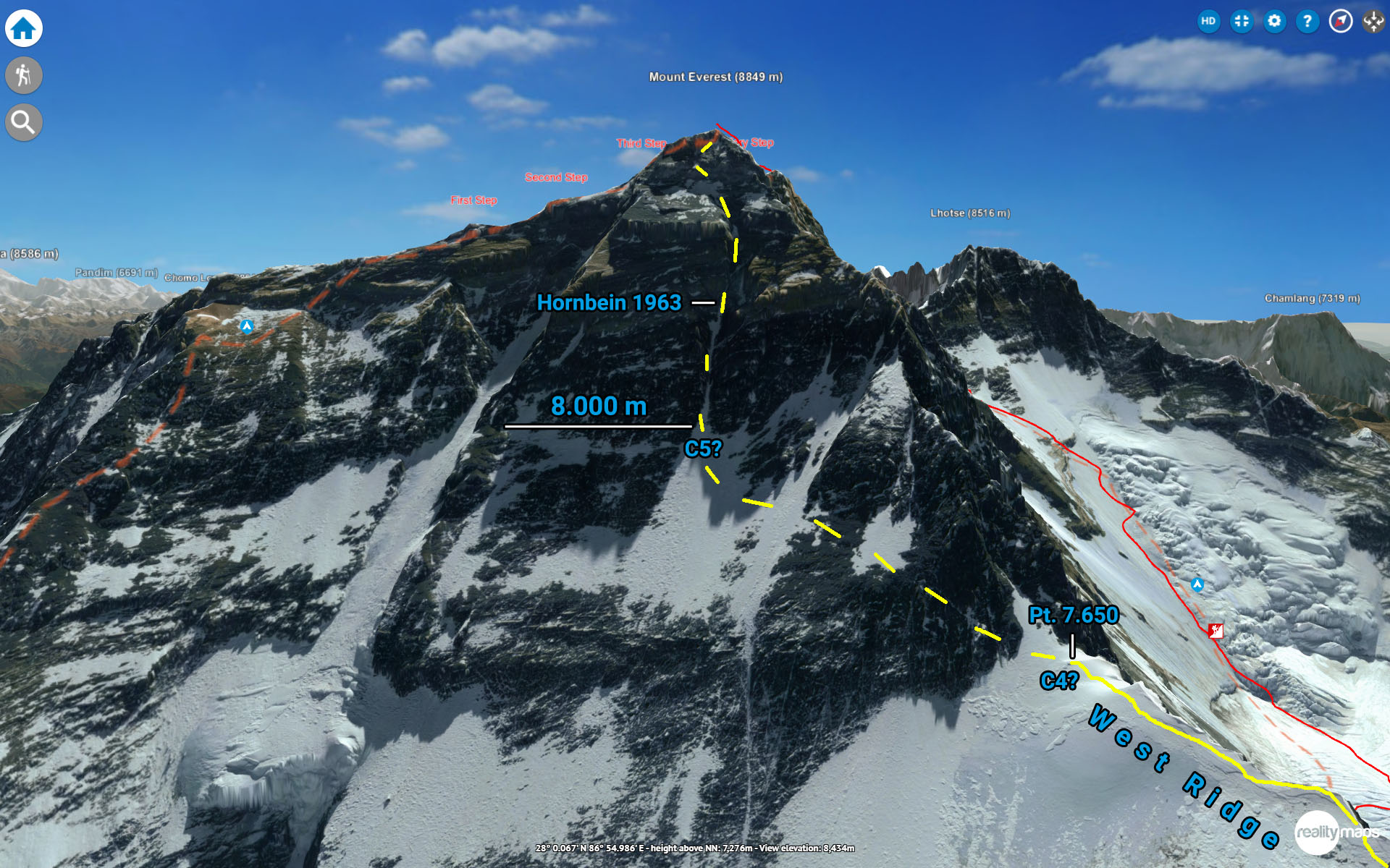
Jost stated, that this years goal would be reaching a highpoint of 8000 m. This would be the highest point ever reached in winter on the West Ridge:
“I want to reach 8,000 meters of altitude. The highest altitude ever reached in winter on the West Ridge was 7,500 meters (in the winter of 1984/85 by a French expedition). Even if I do manage to cross that milestone, it would be a success in some way.”
Before that, he will first have to make his way up to col Lho La, which is an expedition itself. In 2020 he set up C1 on the col at approx. 6.050 m. This time, he set up C1 further down, claiming it would be “more efficient”. According to his gps positions, his route up to the col has also changed, bypassing both the vertical step above the snowfield and the bottom part of the serac on the left, ultimately reaching C1 at 5.713 m.
These changes are probably partly based on his experiences in 2020 when part of the serac collapsed, luckily without him being anywhere close.
Col Lho La (C2)
Col Lho La is a high plateau between Khumbutse and Mount Everest, covered by glaciers and heavily exposed to wind and potential avalanches from both sides. In 1974 a french team was swept away by an avalanche when trying to find a direct route up to the West Ridge, resulting in six deaths.
C2 is located on the col at around 6.000. It is a bit further down and south of 2020’s C1, possibly trying to evade the serac high above and better protected from the wind. Jost will yet again have to dig as deep into the snow as possible, to establish a solid place for his tent and hope it can withstand the winter storms.
The winds are one of the determining factors up here. In winter 2020 Jost had to battle wind speeds over 100 km/h and his tent got destroyed. Jost stated, that a solid weather window with wind speeds up to max. 40 km/h is mandatory. Otherwise, there is no chance of moving up any further.
Beforehand, the acclimatization process requires a couple of cycles between C2 and BC, spending a couple of nights in C1 on the way.

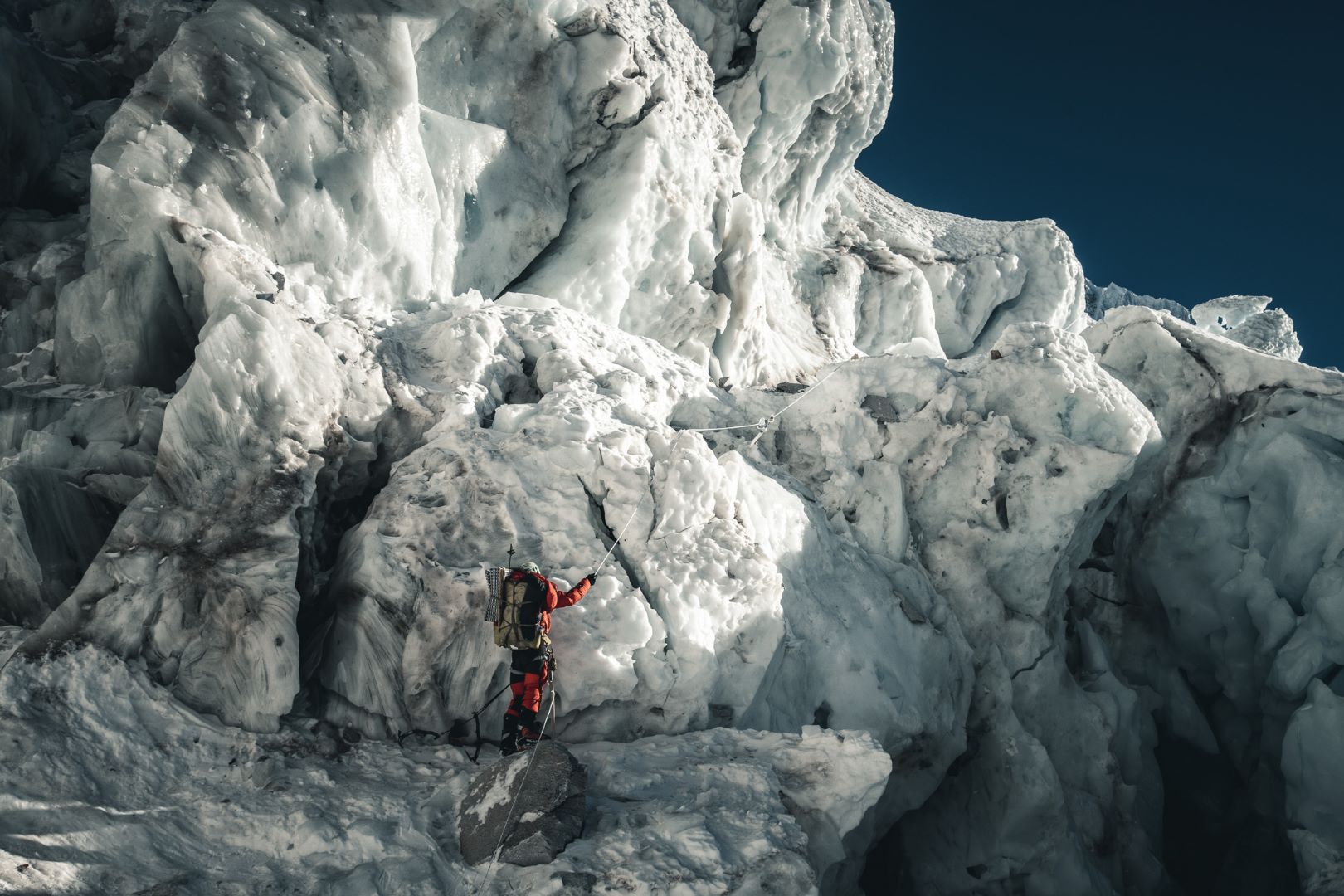
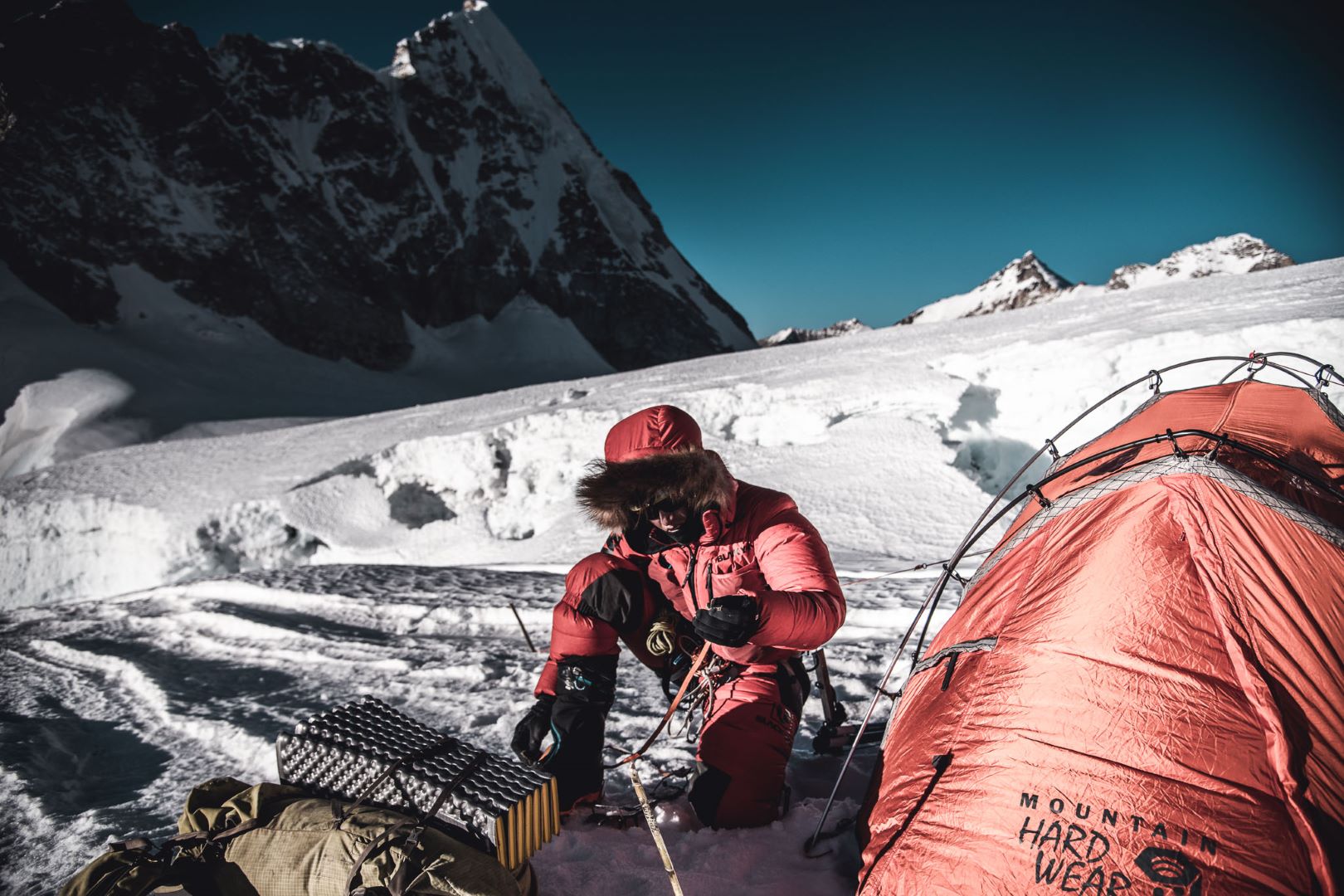
Jost preparing 2020’s C1 on Lho La (6.050 m), January 2020
"Die Routen virtuell zu erkunden und die schrittweise Bewertung der Optionen in Kombination mit Tourberichten waren für meine Vorbereitung sehr wertvoll. Gleichzeitig erleichterte das 3D-Live-Tracking die Kommunikation erheblich und half vielen Menschen, daran teilzunehmen."
(Jost Kobusch)
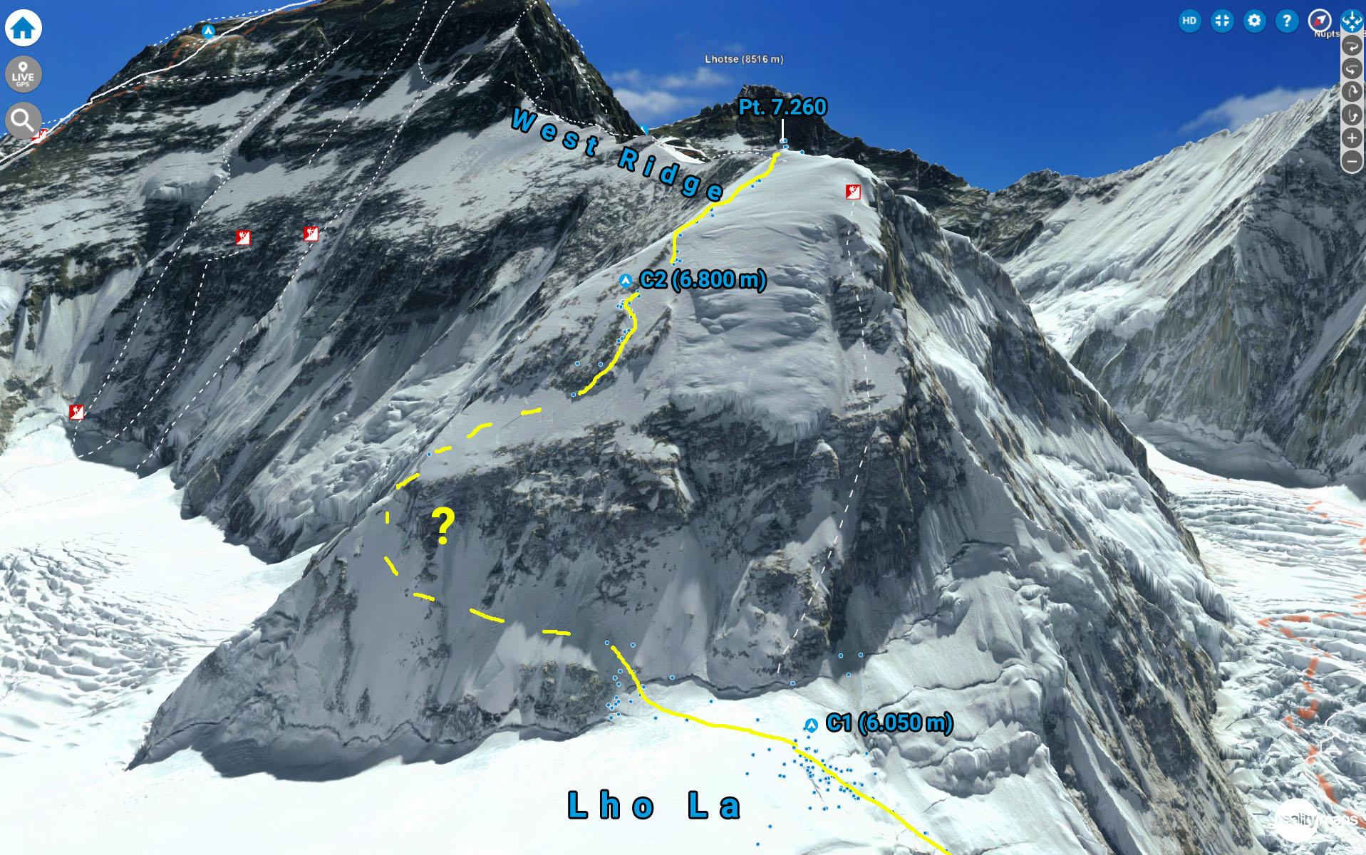
From C2 to C3
Next, a steep, triangle-shaped rock face needs to be climbed in order to reach the beginning of the West Ridge, that lies 1.200 m above. In terms of dimensions, this wall alone compares to the great North Face of the Grandes Jorasses, but less steep (on average 45°). A couple hundred meters up the wall, a steep and rocky belt stretches horizontally from one side to another, creating a challenging obstacle.
In 1979, a strong team from Yugoslavia took the direct line up the ridge, passing the hanging glacier at 6.500 m on the right and proceeded to reach the summit in May 1979.
In our 3D map it appears, that there could be an easier passing on the far left side, making use of a snowy section on the North Ridge. This would require a long traverse beforehand but might me line of least resistance. We assume that Jost made use of this passage on his last attempt, but no GPS samples where sent for that section. Above, a smaller rocky section can be passed on the right side, leading up to C3 on 6.800 m, still a couple of hours below the ridge but protected by the surrounding rocky fins.
This year though, it appears as if Jost is looking for a more direct way straight through the central part of the wall, as his positions from January 2nd and 4th show. He noted that there was a lot of icefall which he is trying to evade on the far left side of the serac.
The West Ridge
In Februar 2020 Jost reached his highpoint at the beginning of the ridge at 7.300 m and afterwards climbed back to C2 in an 8 hour push.
This time, in order to reach his goal, the beginning of the Hornbein Couloir @ 8.000 m, he would probably have to establish C3 somewhere on the ridge. That means carrying a lot more weight up the ridge and also some more trips down to the lower camps in order to get properly acclimatized. Up here, in the so called death zone above 7000 m, the body doesn’t regenerate anymore and the lack of oxygen will become more and more problematic. Finding a suitable place for the tent will be even harder than on Lho La, since the ridge is more exposed and higher up in an area, where during that time of the year, the winter jetstreams are raging relentlessly.

The headwall beyond the ridge
Originally, Jost planned C4 at the end of the ridge at approx. 7.650 m. From here, the original West Ridge route from Tom Hornbein and Willy Unsoeld (1963) traverses left into the northwest face and summit pyramid of Everest.
A rocky section is followed by a snow/icefield that leads up to 8.000 m, where the Hornbein Couloir cuts traight through the steep headwall, around 45°- 50° steep. The difficulty of the couloir and the rocky section below will largely depend on snow coverage
For a summit attempt, a fifth camp would be necessary at around 8.000 m.
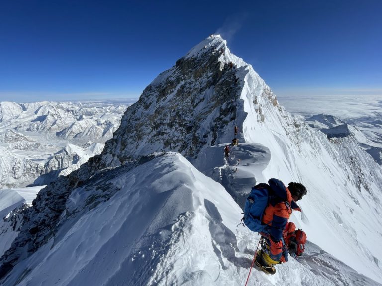
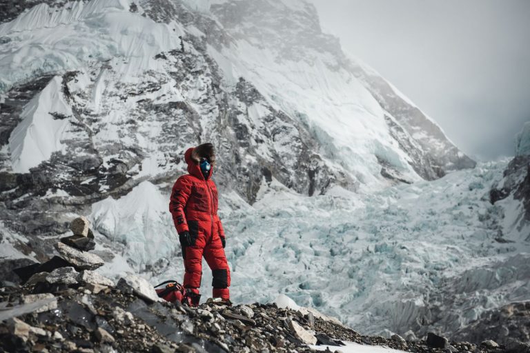
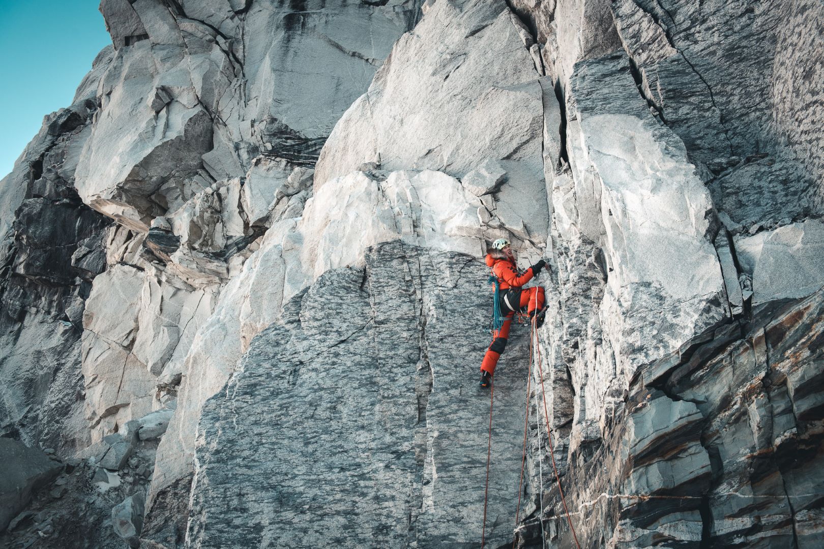
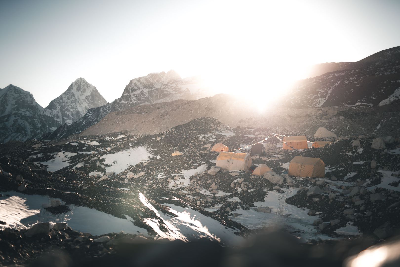
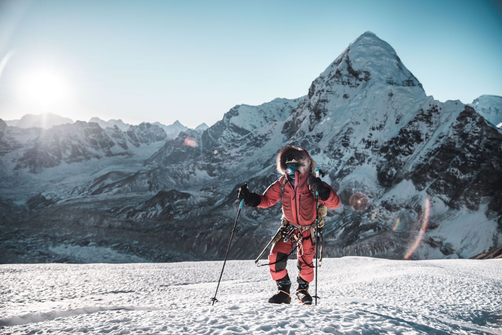
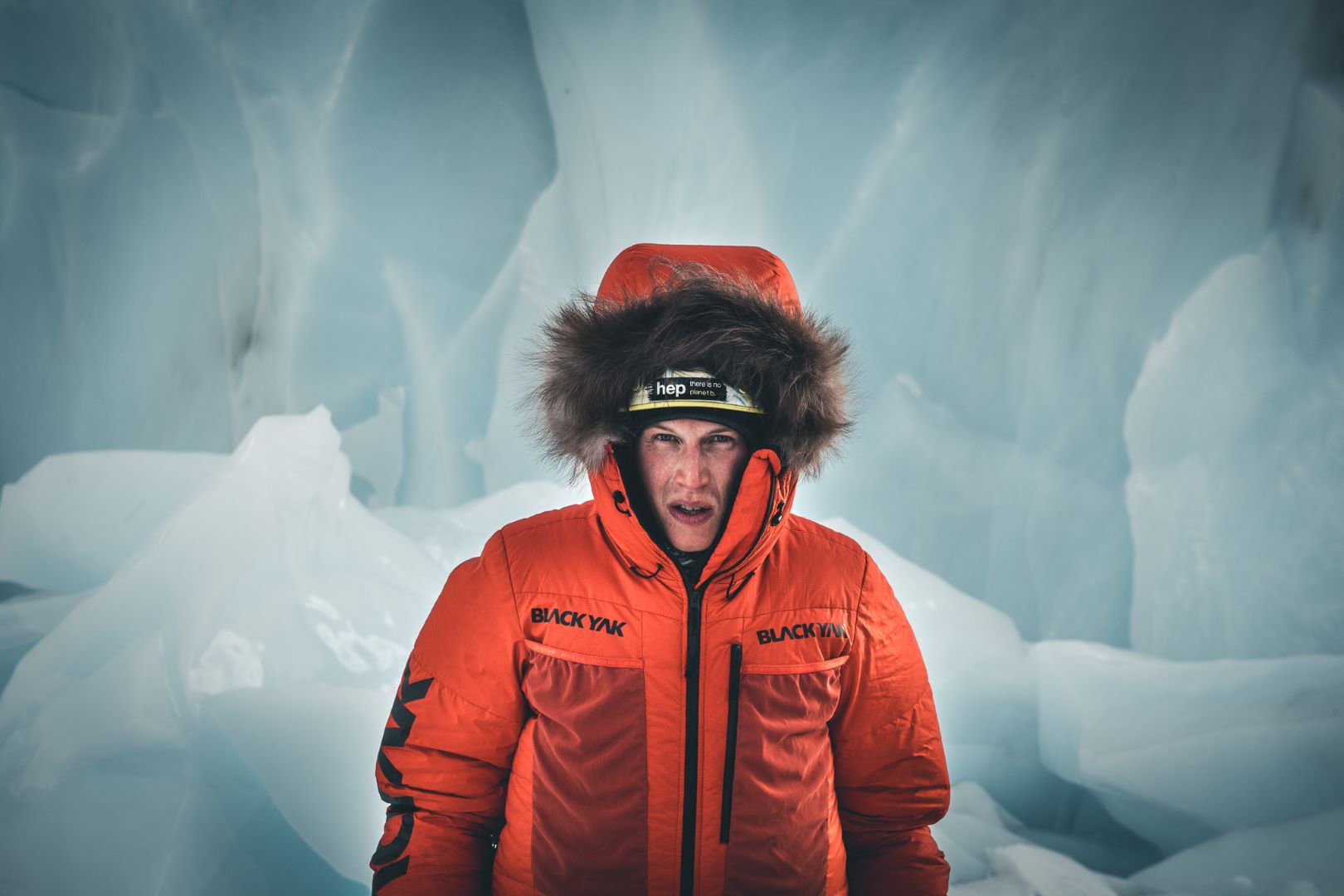
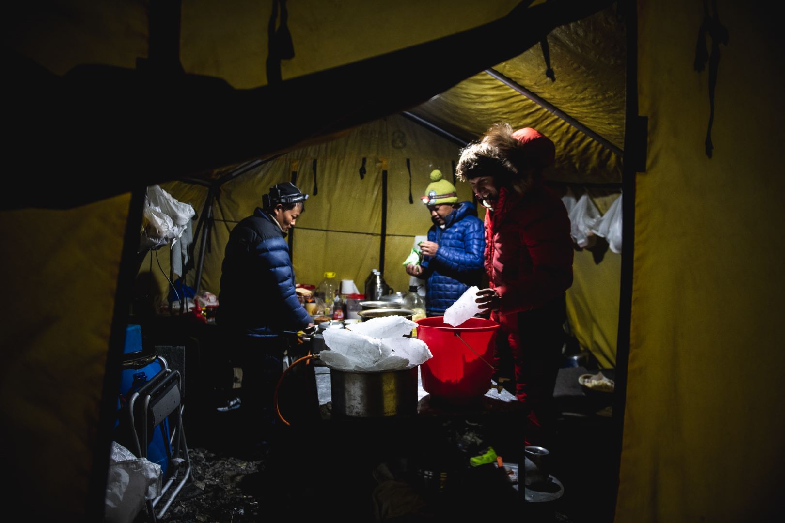
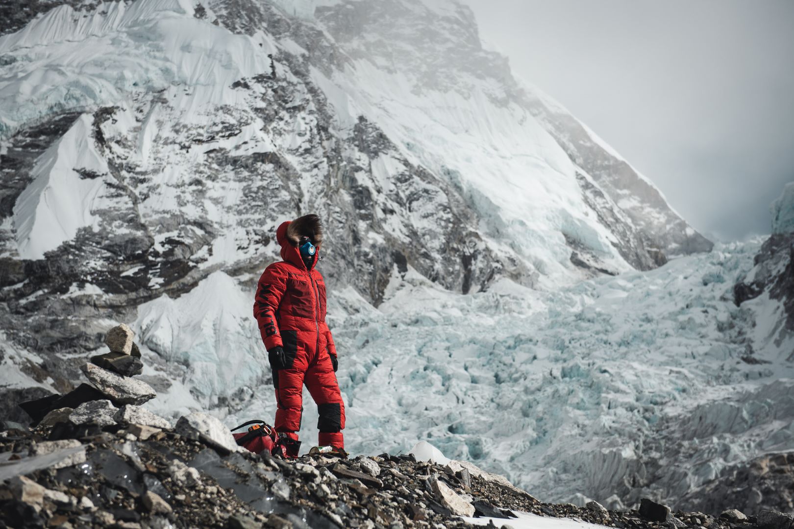
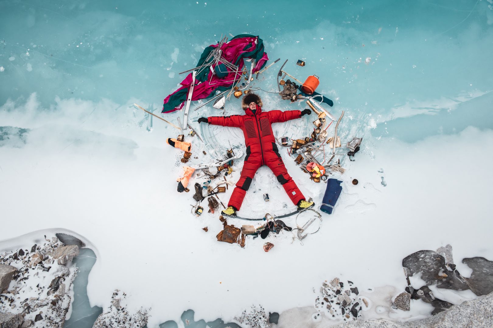
Photos from Jost's Everest expedition (winter 2019/2020)
© Daniel Hug ● @terragraphy ● www.daniel-hug.com
