Island Peak 6.189 m
Die Besteigung des Island Peak (Imja Tse, 6.189 m) ist eine der populärsten Hochtouren in Nepal. Sie kombiniert ein klassisches Trekking mit einer technisch wenig schwierigen, aber physisch fordernden Gipfelbesteigung.
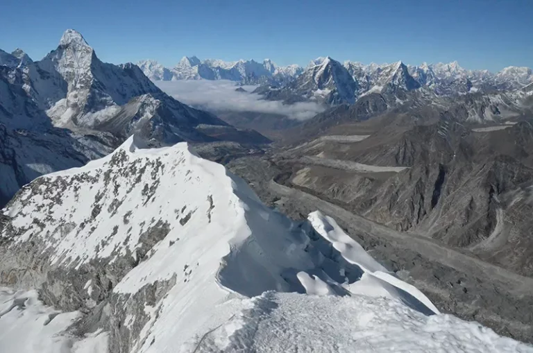
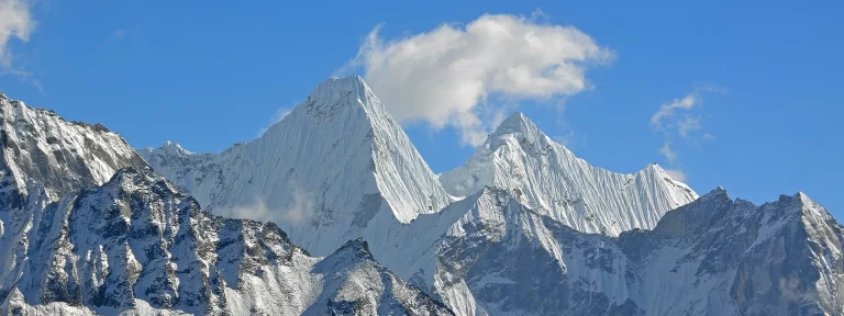
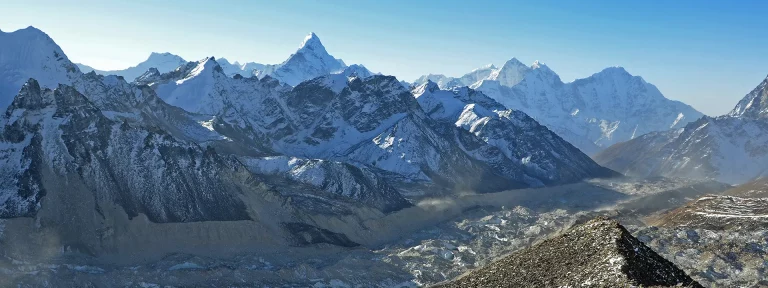
Der Island Peak (Imja Tse) liegt zwischen der gewaltigen Lhotse-Südwand und dem Ama Dablam. Der Berg wurde von Eric Shipton Island Peak genannt, da der Gipfel wie eine Insel aus der ihn umgebenden Eiswüste heraussticht. 1983 wurde er in Imja Tse umbenannt, umgangssprachlich wurde jedoch weiter der Name Island Peak genutzt. Die Erstbesteigung fand 1956 durch ein Schweizer Bergsteigerteam als ein Training für die Besteigung des Mount Everest und Lhotse statt.
Die Route ist im alpinen Bereich meist mit WS (wenig schwierig) eingestuft. Für die Besteigung werden meist 3 Tage eingeplant.
Du benötigst Kenntnisse im Umgang mit Steigeisen, Pickel und der Jumar-Steigklemme für Fixseile. Die größte Herausforderung ist eine etwa 150 Meter hohe, bis zu 55° steile Eisflanke, die mit Hilfe von Fixseilen erstiegen wird und die direkt zum steilen Gipfelgrat führt.
Island Peak - Tag 1
Start: Dingboche (4.336 m)
Ziel: Island Peak Base Camp (5.072 m) Höhenunterschied: 700 m
Länge: 8 km, Dauer: 4–5 Stunden
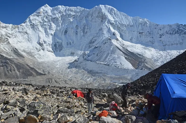
Von Lukla nach Dingboche kommst du über den Everest Basecamp Treck. Der Weg von Dingboche führt in leichter Steigung durch ein weites Tal mit einem Gebirgsfluss. Hier weiden Yaks. Weiter talaufwärts folgt der Weg dem Kamm einer Gletschermoräne. Links überragt der Lhotse das Tal, rechts der Ama Dablam und vor einem nun immer besser sichtbar der 6.189 m hohe Island Peak. Schließlich geht es neben der Moräne des Imja Gletschersees weiter. Den dahintergelegenen See kann man nur ahnen. Felsen, Sand und Steine und das wenige Gras, alles schimmert hier wie von Silber überzogen. Ein kurzer Aufstieg vom Basecamp auf die Moräne daneben ermöglicht den Blick auf den riesigen Gletschersee.
Island Peak - Tag 2
Start: Base Camp (5.070 m)
Ziel: High Camp (5.550 m)
Höhenunterschied: 450 m
Länge: 2 km, Dauer: 2 Stunden
Das Einplanen eines High Camps ist eine taktisch kluge Entscheidung, die den Erfolg am Gipfeltag deutlich steigern kann. Während viele Gruppen direkt vom Basislager aus starten, verkürzt die Übernachtung im High Camp den extrem anstrengenden Gipfeltag um etwa 2–3 Stunden und knapp 500 Höhenmeter.
Es ist kein langer Tag (ca. 2–3 Stunden), was dir hilft, Kraft zu sparen. Das High Camp selbst klebt förmlich am Hang zwischen Felsen. Der Pfad schlängelt sich zunächst über einige Serpentinen und geht dann in grobes Blockgelände über. Hier ist Trittsicherheit gefragt, da man über größere Felsen steigen muss.
Island Peak - Tag 3
Start: Island Peak High Camp (5.550 m)
Ziel: Island Peak (6.189 m)
Höhenunterschied: 650 m
Länge: 3 km, Dauer: mit Abstieg zum Base camp 6-8 Stunden
Start gegen 2 Uhr morgens. In der Dunkelheit der Nacht kletterst du über Felsstufen und steile Rinnen (leichte Kletterei, teils Fixseile), bis du den Crampon Point erreichst. Hier werden die Steigeisen angelegt. Nach Überquerung des Gletascher mit einigen Gletscherspalten erreichst du eine bis zu 55 Grad steile Eisflanke, die an einem Fixseil mittels Jumar überwunden wird. Zum höchsten Punkt führt ein schmaler, exponierter Grat.
Der Rückweg zum High Camp erfolgt durch Abseilen an der Wand und vorsichtiges Absteigen. Nach einer kurzen Rast im Base Camp meist direkter Abstieg bis nach Chhukung (4.730 m), um in die sauerstoffreichere Luft zurückzukehren.